

€ 12,90 Gratis verzending

Gesponsorde links
|
|
12,90 |
Naar shop
|

|
12,90 |
Naar shop
|

|
15,00
12,90 |
Naar shop
|
| VERGELIJK ALLE AANBIEDERS (3) | ||
 Beschrijving
Vergelijk aanbieders (3)
Gesponsorde links · Sommige shops betalen ons een vergoeding
€ 12,90 Gratis verzending
€ 12,90 Gratis verzending
€ 15,00 € 12,90 € 2,99 verzendkosten Totaal € 15,89
Winkels met andere maten
Beschrijving
(1)
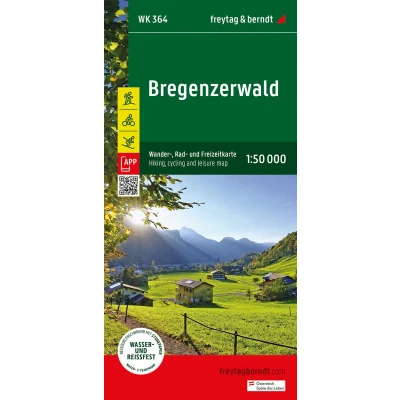
The "Bregenzerwald Hiking Map 1:50,000" is regularly revised and contains updated information on hiking trails, cycling and mountain bike routes, huts, natural monuments, cultural sights and leisure facilities Thanks to the detailed digital cartography and precise scales, freytag & berndt hiking maps are ideal companions for hiking, mountaineering and ski tours. The 'Bregenzerwald Hiking Map 1:50,000' is regularly revised and contains updated information on hiking trails, cycling and mountain bike routes, huts, natural monuments, cultural sights and leisure facilities. The enclosed information booklet contains a selection of the best hiking trails, cycle paths and mountain bike routes as well as a brief description of the individual communities and their leisure activities. (Language: German) Leisure information, hiking and long-distance hiking trails, mountain bike and cycling tours, location register with postal codes, GPS compatible, via ferrata, ski route, cross-country ski route, Nordic walking route; Region: Bregenzerwald, Kleinwalsertal, Großes Walsertal, Vorarlberg, Austria, Allgäu Alps; Special themed hiking trails: Northern Alpine Trail, Central Alpine Trail, Pre-Alpine Trail, St. James Way, Via Alpina, family hike to the Diedamskopf, circular hiking trail to the Hohe Kugel; Special cycling and mountain bike tours: Rhine Valley cycle path, Lake Constance cycle path, Bregenzerwald cycle path, Auf der Hohe Kugel, Kleinwalsertaler Tälerrunde; Environment maps: WK 351, WK 374, WK 375, WK 5364, WK 5374, WK D10;
 Prijshistorie
* Prijshistorie bevat geen data van Amazon, Amazon Marketplace.
Prijzen voor het laatst bijgewerkt op:
 Gerelateerde resultaten
 Productspecificaties


