
Collins Road Atlas 2027 Big Britain and Northern Ireland
Uitgelicht

|
16,99 |
Naar shop
|

|
16,99 |
Naar shop
|

|
16,99 |
Naar shop
|
| VERGELIJK ALLE AANBIEDERS (3) | ||
 Beschrijving
Bol
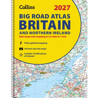
Explore Britain with easy-to-read mapping from Collins. Explore Britain with easy-to-read mapping from Collins. The ultimate 3.2 miles to 1 inch scale large-format, spiral-bound road atlas of Britain, featuring Collins’ popular and well-established road mapping, and designed for exceptional clarity and ease of use. The atlas has a wide range of urban area maps at even larger scale and 64 detailed town centre street plans. This fully updated road atlas covers the whole of Britain with each scale of mapping colour-coded for ease of use. The smallest scale maps are great for long-distance route planning and the street plans help you locate your final destination. Main features: Easy to use, clear road maps at a scale of 3.2 miles to 1 inch of England, Wales and Southern Scotland. Northern Scotland is shown at 5 miles to 1 inch Route-planning section including maps at a scale of 15.8 miles to 1 inch, motorway services information and a handy distance calculator 22 urban area approach maps at 1 mile to 1 inch which clearly show the best routes through and into urban areas 64 street maps focused on town centres showing places of interest, car park locations and one-way streets Updated Park & Ride locations, new rail stations and extensions to tram lines in Blackpool and Edinburgh Over 30 categories of places of interest including castles, theme parks, sports venues and surfing beaches Full postcodes for the top 1000 places of interest – ideal for use alongside sat-nav systems Now includes dual Welsh / English names for Welsh locations, for example, Caerdydd / Cardiff


 Beschrijving
(1)
Beschrijving
(1)
Explore Britain with easy-to-read mapping from Collins. Explore Britain with easy-to-read mapping from Collins. The ultimate 3.2 miles to 1 inch scale large-format, spiral-bound road atlas of Britain, featuring Collins’ popular and well-established road mapping, and designed for exceptional clarity and ease of use. The atlas has a wide range of urban area maps at even larger scale and 64 detailed town centre street plans. This fully updated road atlas covers the whole of Britain with each scale of mapping colour-coded for ease of use. The smallest scale maps are great for long-distance route planning and the street plans help you locate your final destination. Main features: Easy to use, clear road maps at a scale of 3.2 miles to 1 inch of England, Wales and Southern Scotland. Northern Scotland is shown at 5 miles to 1 inch Route-planning section including maps at a scale of 15.8 miles to 1 inch, motorway services information and a handy distance calculator 22 urban area approach maps at 1 mile to 1 inch which clearly show the best routes through and into urban areas 64 street maps focused on town centres showing places of interest, car park locations and one-way streets Updated Park & Ride locations, new rail stations and extensions to tram lines in Blackpool and Edinburgh Over 30 categories of places of interest including castles, theme parks, sports venues and surfing beaches Full postcodes for the top 1000 places of interest – ideal for use alongside sat-nav systems Now includes dual Welsh / English names for Welsh locations, for example, Caerdydd / Cardiff
 Productspecificaties
 Prijshistorie
* Prijshistorie bevat geen data van Amazon, Amazon Marketplace.
Prijzen voor het laatst bijgewerkt op:
 Gerelateerde resultaten


