

€ 13,56 Gratis verzending

Gesponsorde links
|
|
13,56 |
Naar shop
|

|
15,10 |
Naar shop
|
| VERGELIJK ALLE AANBIEDERS (2) | ||
 Beschrijving
Vergelijk aanbieders (2)
Gesponsorde links · Sommige shops betalen ons een vergoeding
€ 13,56 Gratis verzending
€ 15,10 € 2,99 verzendkosten Totaal € 18,09
Winkels met andere maten
Beschrijving
(1)
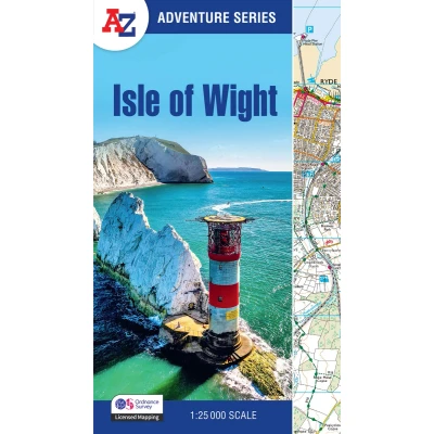
The A-Z Adventure Series of maps combines the best of OS and A-Z, creating the perfect companion for walkers, off-road cyclists, horse riders and anyone wishing to explore the great outdoors. The A-Z Adventure Series of maps combines the best of OS and A-Z, creating the perfect companion for walkers, off-road cyclists, horse riders and anyone wishing to explore the great outdoors. The Isle of Wight is an island off the south coast of England, celebrated for its varied landscapes and coastal beauty. It offers breathtaking views of dramatic cliffs, rolling downs, and sandy beaches, including iconic landmarks such as The Needles and Tennyson Down. It is no surprise that walkers are drawn here to enjoy the many and varied routes available, from gentle coastal strolls to longer hikes across countryside and coastline. This A-Z Adventure Atlas of the Isle of Wight features over 30 pages of continuous Ordnance Survey 1:25 000 mapping covering the entire island. Unlike original OS sheets, there is a comprehensive index to towns, villages, hamlets and locations, natural features, nature reserves, car parks and youth hostels. Each index entry has a page reference and a six figure National Grid Reference. With a book size of 240mm x 134mm, it is the same size as the standard folded OS map. Other National Trails available within the A-Z Adventure series: Cotswold Way, Pembrokeshire Coast Path, South Downs Way, and SW Coast Path.
 Prijshistorie
* Prijshistorie bevat geen data van Amazon.
Prijzen voor het laatst bijgewerkt op:
 Gerelateerde resultaten
 Productspecificaties


