
Noorwegen Zuid Wegenkaart 1:250.000 - Freytag & Berndt - Oslo Bergen Stavanger met Autoferries AK 0655
Uitgelicht

|
12,90 |
Naar shop
|

|
12,90 |
Naar shop
|

|
15,99
12,90 |
Naar shop
|
| VERGELIJK ALLE AANBIEDERS (4) | ||
 Beschrijving
Bol
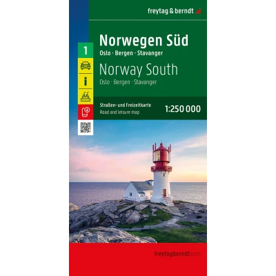
This detailed map of Norway covers the southern part of the country, south of a Voss-Hamar line, including the regions of Bergen, Stavanger, and Oslo. Features include relief mapping, distances, information on various ferries, and a multilingual legend in French, English, German, and Italian. Road map of southern Norway, published by Freytag & Berndt. This detailed map of Norway covers the southern part of the country, south of a Voss-Hamar line, including the regions of Bergen, Stavanger, and Oslo. Features include relief mapping, distances, information on various ferries, and a multilingual legend in French, English, German, and Italian. Also included: a booklet with an index of Norwegian towns and postal codes. Scale: 1:250,000 (1 cm = 2.5 km).


 Beschrijving
(1)
Beschrijving
(1)
This detailed map of Norway covers the southern part of the country, south of a Voss-Hamar line, including the regions of Bergen, Stavanger, and Oslo. Features include relief mapping, distances, information on various ferries, and a multilingual legend in French, English, German, and Italian. Road map of southern Norway, published by Freytag & Berndt. This detailed map of Norway covers the southern part of the country, south of a Voss-Hamar line, including the regions of Bergen, Stavanger, and Oslo. Features include relief mapping, distances, information on various ferries, and a multilingual legend in French, English, German, and Italian. Also included: a booklet with an index of Norwegian towns and postal codes. Scale: 1:250,000 (1 cm = 2.5 km).
 Productspecificaties
 Prijshistorie
* Prijshistorie bevat geen data van Amazon, Amazon Marketplace.
Prijzen voor het laatst bijgewerkt op:
 Gerelateerde resultaten


