


€ 20,00 € 2,99 verzendkosten Totaal € 22,99

Uitgelicht
|
|
20,00 |
Naar shop
|
| VERGELIJK ALLE AANBIEDERS (1) | ||
 Beschrijving
Vergelijk aanbieders (1)
€ 20,00 € 2,99 verzendkosten Totaal € 22,99
Winkels met andere maten
Beschrijving
(1)
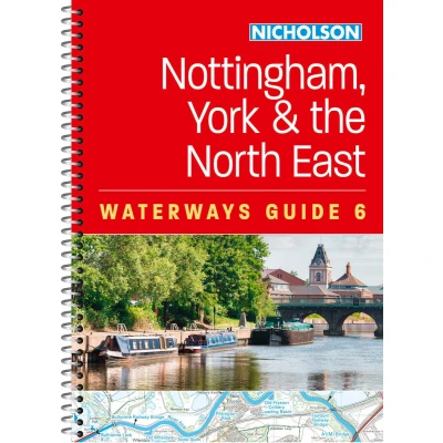
Explore Britain's canals and rivers with the Nicholson bestselling guides. For all users of the inland waterways. This established, popular and practical guide covers the canals and waterways between York and the River Trent south of Nottingham. Explore Britain's canals and rivers with the Nicholson bestselling guides. For all users of the inland waterways. This established, popular and practical guide covers the canals and waterways between York and the River Trent south of Nottingham. Waterways covered in this guide are the Aire & Calder Navigation; Chesterfield Canal; River Derwent and the Pocklington Canal; Fossdyke & Witham Navigations; Grantham Canal; River Ouse, River Ure and Ripon Canal; Selby Canal; South Yorkshire Navigations; and River Trent. The detailed up-to-date maps clearly show the location of essential features such as locks, towpaths and boating facilities, as well as pubs, shops and restaurants in the area. There are comprehensive navigational notes and descriptive text on the history of each canal, and on local services and places of interest, for which postcodes are included – ideal for use with sat-navs. Scale: 2 inches = 1 mile, 3 cm = 1 km. This practical A5 guide features 'lie flat' spiral binding and 'book mark' back cover flap for ease of reference. In print for more than 50 years, the Nicholson guides to the waterways have always been a vital part of journeys along Britain’s canals and rivers. These bestselling guides are designed for anyone and everyone with an interest in Britain’s inland waterways – from experienced boaters to those planning their first boat trip, as well as walkers, cyclists and visitors.
 Productspecificaties
| EAN |
|
|---|---|
| Maat |
|
 Prijshistorie
 Prijzen voor het laatst bijgewerkt op:
 Gerelateerde resultaten


