
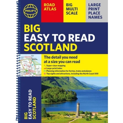
Philip's Big Easy to read Scotland Road Atlas (Spiral A3): All the detail you need at a size can
Uitgelicht

|
18,52 |
Naar shop
|

|
18,52 |
Naar shop
|
| VERGELIJK ALLE AANBIEDERS (2) | ||
 Beschrijving
Bol
Philip''s Big Easy Read Scotland Road Atlas is an exceptionally clear guide to the best of Scotland from the market-leading map makers. Reliable and up to date, the fully indexed mapping is accompanied by town plans, tourist and planning information, and spectacular scenic routes including the celebrated North Coast 500. The detailed yet easy-read maps show national parks, cultural and historical attractions, long-distance footpaths and much, much more.· Exceptional clarity with large-print place names and large-scale maps· Large-print index· Super-sized A3 pages for easy reading on the go· Shows most of Scotland at a scale of 1 inch to 2.37 miles (1:150 000); most islands and north Scotland at 1 inch to 3.16 miles (1:200 000) and 1 inch to 3.95 miles (1:250 000)· Packed with ideas and details about places to visit· Easy to read mapping with the NC500, long-distance footpaths, national parks, museums, castles and more· Town centre maps, fully indexed for easy navigation· Clear travel-planning information - trains, planes and ferries· Hard-wearing and practical A3 format with spiral binding


 Beschrijving
(1)
Beschrijving
(1)
Philip''s Big Easy Read Scotland Road Atlas is an exceptionally clear guide to the best of Scotland from the market-leading map makers. Reliable and up to date, the fully indexed mapping is accompanied by town plans, tourist and planning information, and spectacular scenic routes including the celebrated North Coast 500. The detailed yet easy-read maps show national parks, cultural and historical attractions, long-distance footpaths and much, much more.· Exceptional clarity with large-print place names and large-scale maps· Large-print index· Super-sized A3 pages for easy reading on the go· Shows most of Scotland at a scale of 1 inch to 2.37 miles (1:150 000); most islands and north Scotland at 1 inch to 3.16 miles (1:200 000) and 1 inch to 3.95 miles (1:250 000)· Packed with ideas and details about places to visit· Easy to read mapping with the NC500, long-distance footpaths, national parks, museums, castles and more· Town centre maps, fully indexed for easy navigation· Clear travel-planning information - trains, planes and ferries· Hard-wearing and practical A3 format with spiral binding
 Productspecificaties
 Prijshistorie
* Prijshistorie bevat geen data van Amazon Marketplace.
Prijzen voor het laatst bijgewerkt op:
 Gerelateerde resultaten


