


€ 16,00 € 2,99 verzendkosten Totaal € 18,99

Uitgelicht
|
|
16,00 |
Naar shop
|

|
16,86 |
Naar shop
|

|
16,86 |
Naar shop
|
| VERGELIJK ALLE AANBIEDERS (3) | ||
 Beschrijving
Vergelijk aanbieders (3)
€ 16,00 € 2,99 verzendkosten Totaal € 18,99
€ 16,86 Gratis verzending
€ 16,86 Gratis verzending
Winkels met andere maten
Beschrijving
(1)
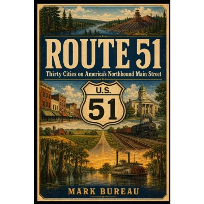
What can one highway reveal about America? Route 51 follows a northbound line through thirty communities-from LaPlace, Louisiana, where the Mississippi River and wetlands shape the road, to Hurley, Wisconsin, at the edge of Lake Superior's iron country. Beneath the modern pavement lie older stories: Indigenous travel corridors, river landings, wagon roads, rail lines, courthouse squares, farm markets, timber towns, mining districts, and generations of local work. Along the way, Mark Bureau explores how transportation shaped each place and how each community adapted when the routes changed. Ponchatoula's strawberries, McComb's railroad shops, Canton's courthouse square, Millington's naval history, Fulton's border trade, Carbondale's university, Portage's ancient carrying place, Wausau's lumber economy, and Minocqua's resort landscape become parts of one connected American story. Organized into six regional sections and richly illustrated in a vintage travel-poster style, Route 51 brings together local history, transportation history, architecture, labor, agriculture, industry, and civic memory. The result is more than a guide to a highway. It is a portrait of the communities that made America's northbound main street-and of the roads, rails, rivers, and people that continue to hold those places together. For readers who enjoy American history, historic highways, railroad history, small-town architecture, regional travel, and the stories hidden in ordinary landscapes.
 Prijshistorie
 * Prijshistorie bevat geen data van Amazon, Amazon Marketplace.
Prijzen voor het laatst bijgewerkt op:
 Gerelateerde resultaten
 Productspecificaties


